WRTII, Part 3: We’re Marching to Zion

This is Part 3 in a series on a road trip. Past parts here: Intro | Part 1 | Part 2

Friday morning dawns warmly, a sign that Joshua Tree’s cold snap is coming to an end. I won’t get to experience the Mojave at full blast, though: I have a date with Zion. I take down my camp efficiently, double-check for forgotten items, and set off. I make one last run down Joshua Tree’s main road, just beating the lane closure for construction, and gas up in Twentynine Palms. Next, I’m off on the loneliest stretch of road I’ll travel this week: a series of two-lane highways that don’t even earn a state or county number designation. They’re just solitary strips of asphalt that extend out into eternity, rising and falling over the ranges of the Mojave moonscape. The handful of hamlets I pass through are visible from miles off, usually tucked into valleys here on the edge of civilization.

Past I-40 I rise into the Mojave National Reserve, where the Joshua trees return on the high ground, and flocks of buzzards circle overhead, honing in on the roadkill. One brief stretch of road takes me along the old Route 66, meaning there are a few mostly empty roadside motels from a different era, but that’s about all there is to see. I can see the monster casino announcing the Nevada border from miles off, and catch I-15 just before the crossing. The interstate seems excessive after so many miles of desolate road, with constant truck traffic and six broad lanes and a large median, though it’s not as if it’s taking any land away from anything out here.

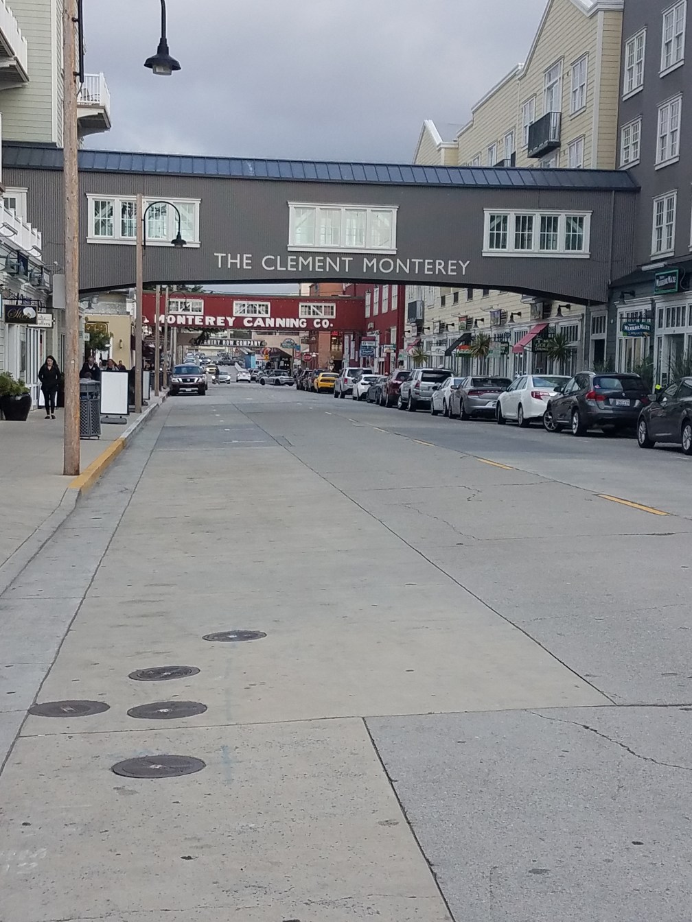
Primm, the garish border town, welcomes me to Nevada, and just a short while later I get my first look at Las Vegas. At first glance, it does impress, as this monster of a metropolitan area rises out of the desert, and the towers along The Strip loom over it all. I cut off the freeway to find an REI and replace my ground fly, and maneuver down an eight-lane stoplight-riddled highway along vast tracts of housing in suburban Henderson. On my way back through to the Vegas airport three days later, I take a tour down The Strip, and conclude that the city is both great and awful. It’s affordable, spacious, and new, but also a wasteful realm of kitsch whose greatest monuments are plaster replicas of those of other cities. The flight attendants escort one woman who is too intoxicated off my plane after everyone is on board, and the two young women next to me are busy recounting tales of their adventures, ensuring that what happened in Vegas will not stay in Vegas. I’m sure plenty of Las Vegans (not to be confused with the other type of vegans) lead perfectly normal and happy lives, but the place as a whole celebrates a culture of frivolity and temporary escapes from memory. The world needs its frivolity and sin, mind you, but to make its worship the center of a place seems to rob its entire sense of place. Vegas, I muse, is not a place at all, but a place where people go to escape other places, a sort of preview of some marvelously fake virtual reality world that could yet come to be. It is no place for me. I march on to Zion.

Late-stage Joan Didion carries me through the wastes east of Vegas in Nevada in Arizona—hardly a source of happy thoughts—but delight comes anew in the Virgin River gorge. Here, I-15 slithers through a narrow cut in the mountains for ten miles as it winds and loops through an array of stunning cliffs, the river barely visible down below as it weaves back and forth around the viaduct. The road opens back up to the plateau above, and I pass through St. George, Utah’s southern gateway to canyon country. I begin the final stage of my drive, some thirty miles from the freeway to the gates of Zion. The first stretch along Highway 9 worries me—strips of hotels and tourist traps as far as the eye can see—but before long it rises up into a land of layer cake red and white cliffs, tasty previews of the feast to come. I weave into Springdale, the resort town just beneath the ramparts of Zion, and go through a mercifully short line at the park gate.

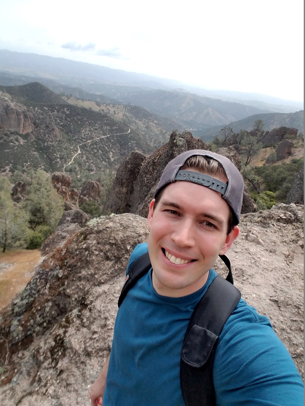
With all due respect to the other parks I’ve visited on this tour, Zion is to be the closing highlight. Zion Canyon, known as Mukuntuweap by the Paiutes, so stunned early Mormon pioneers that they named it for the Promised Land. When Frederick Dellenbaugh brought paintings of the canyon to the 1893 World’s Fair in St. Louis, observers couldn’t believe they were of a real place. The park has exploded in popularity in recent years, so I will have to fight some crowds here—merely reserving a campsite was a harrowing experience in which all 92 available sites disappeared within five minutes of becoming available two weeks prior—but everyone who has been tells me it’s worth the hype.

The chatty campground hosts direct me to my home for the next two nights. For such a beautiful location, it is a thoroughly blah camp, designed to pack as many people as possible into the canyon. My site is a rocky slope baking in the afternoon sun, and is wide open to neighbors on all sides. I find its one semi-flat spot to pitch my tent, take care of those preparatory tasks as quickly as possible, and head to the visitor’s center to catch the a shuttle. In order to relieve the canyon of crowds, Zion bans private vehicles in its peak seasons and runs regular shuttles down its full length. Mine meanders up the canyon and provides marvelous views of the towering cliffs on both sides, along with running commentary from both a recording and the shuttle driver. The peaks along the route have brilliant names that earn any pretention they may convey: the Watchman, the Sentinel, the Great White Throne, and Angel’s Landing. I’m the only passenger on my packed shuttle to disembark at the Court of the Patriarchs stop, where peaks named for Joshua, Isaac, and Abraham loom over the valley. After some struggle to find my route, I locate a bridge across the Virgin River and start a hike up a horse trail.

20180504_160336

‘Edenic’ is the word that comes to mind as I begin my exploration. I’m stunned by the lushness of the valley floor, from pines to cottonwoods to cacti to hanging gardens on the thousand-foot cliffs. The rushing Virgin takes on the greenish tint of the canyon, and offers a striking contrast with the red cliffs on either side. On this stretch of trail, solitude, in spite of the crowds within the park: I see two couples in my first mile and a half of hiking, but other than them, it’s just me and a bunch of flies around the piles of horse dung. I find the crowds again when my trail connects to the path to the Emerald Pools, but they are no bother. I’m more a man of prose than poetry, but I find myself reciting Coleridge’s Kubla Khan in my head as I hike; an absinthe-driven vision of natural splendor seems the only appropriate response to Zion.

In Xanadu did Kubla Khan

A stately pleasure-dome decree:

Where Alph, the sacred river, ran

Through caverns measureless to man

Down to a sunless sea.

At the lower Emerald Pool, water showers down from a cliff above and the trail hugs the wall that wraps behind the cascades, showering hikers with a light mist. Some clambering leads up to the middle and upper pools, more tame oases here amid the jungle. A chorus of frogs chirps at the middle pool, while the upper pool sits in repose beneath the towering cliffs, fed by centuries of steady seepage down the walls. I scramble back down and take another trail up the canyon, and am subjected to yet another string of wonderful river views beneath the imposing walls all around. At the far end of the trail, I catch my first glimpse of Angel’s Landing, a towering buttress of stone that juts out into the canyon’s walls down to its floor, and the site of tomorrow’s hike. It seems wide from here, I try to convince myself.

20180504_162957

I catch a shuttle back down the canyon, but the driver announces that the Zion Lodge at the next stop offers ice cream, so I can’t resist a stop. It’s hardly the wilderness here; the lodge hosts hundreds of guests, and even features a bar selling craft beer. The place is beginning to seem like a theme park, complete with tame gathering deer. (Anywhere else I’d be annoyed by the many animals that seem all too comfortable around humans, but here it just fits the Edenic vibe.) The next day, when on a backcountry trail, my hiking companions and I have a chat with a German woman who laments the overcrowding. In the eight years since her first visit, Springdale has exploded from a sleepy outpost into a full-on resort town, and she says the park only expects its number of visitors to double in the next five years. Given the congestion already, that seems absurd.

The backcountry portions of Zion may still offer some solitude for people like the German woman and my hiking buddies. But given the mediocrity of the campground, I think it’s already best to think of Zion Canyon not as a wilderness, but as a tame garden. Next time I’d prefer to stay in the lodge, or perhaps a cabin in Springdale. Later that evening, on a walk up the paved trail next to the campground, I see a few stone rangers’ cabins across the river. Lamps burn in their windows, all open to catch the sweet evening breeze that pours down the canyon. I imagine their residents pouring themselves some drinks, busting out a deck of cards or pulling some books off the shelves, and in that moment I can’t imagine a more heavenly place to spend an evening.

The wind through the canyon buffets my tent all night, but keeps the temperature pleasant for the first time all trip. My alarm goes off at 5:45 the next morning, with the sun still well behind the canyon walls. I dress quickly and go to meet a Duluth friend and his companion, off on a rapid tour of southern Utah parks, in the visitor’s center parking lot. We become the second, third, and fourth people in line for the 7:00 shuttle, which will be the day’s first up the canyon.

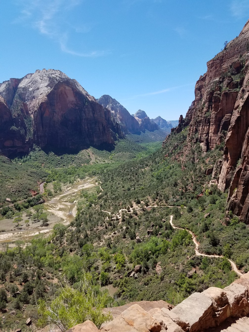
Angel’s Landing is one of the most iconic hikes in the National Park system, as it clambers up a narrow spine of rock with sheer 1,000-foot drop-offs on either side out to a stunning view down the canyon. While only about five miles round trip, it requires 1,500 feet in elevation gain, including a final half mile (some 500 vertical feet) of clambering along chains up its narrow spine. We set an aggressive pace up the two miles of relentless switchbacks to Scout Lookout, and are among the first ten to fifteen people to make our way out on to the chains up the Angel’s Landing extrusion. This is a wise choice: we aren’t dueling anyone for a hold on the chains as we clamber up, and while we have to stop a number of times on the way down, it could be a lot worse. Later in the day, it is: when we pass by on our way down from further hiking shortly after noon, people look like ants crawling up the chains in a slow line. Moreover, on the way down we saw only the first of the climbers with any genuine panic over the heights. As we head down the switchbacks that afternoon in upper 80-degree heat, a lot of people who look patently unfit for this climb are struggling up, some asking naïve questions about how much further they have to go; one man is sitting along a switchback in full sun, retching repeatedly over the edge. Look out below.

20180505_092419

This is not to say I’m some model Angel’s Landing hiker. In fact, I probably have the largest imbalance between physical ability and fear of heights of anyone in that first group up. I cling to every chain for my life while others scoot along freely, and if not for my hiking companions setting the pace, I probably would have wimped out. But I keep my eyes on my feet and march on up to the top, where I sink to a seat as far from the edge as I can, and am quite content to admire the view from there instead of snapping pictures from all over the place. I get the hang of things on the way down, and benefit from some levity when one of my companions inadvertently offs a chipmunk with a stray step. It twitches a bit, and a streak of blood trickles down the rock as a woman on her way up worries over it. Survival of the fittest: the rodents of Angel’s Landing are far too tame thanks to the feeding hands of countless tourists, and this one learned things the hard way. We don’t have the heart to tell the woman what happened. My friend has no remorse.

Fired up by our conquest of Angel’s Landing, we turn away from the crowds and push on up the West Rim Trail, which rises up away from the canyon and into the high plateau. Suddenly, the only people on the trail are two guys with whom our party plays leapfrog between hiking and rest stops on our way up, one truly remarkable trail runner, some backpackers on their way to or from the backcountry sites, and the aforementioned chatty German woman.  While less nerve-inducing than Angel’s Landing, it’s often just as steady in its elevation gain, and offers no shortage of beauty. The rock changes from the red along the canyon to the white caps of the peaks in the area, beginning with a huge white dome just above Scout Lookout. The trail descends into a couple of cool cuts in the rock before another relentless climb through a forest that shows signs of fire, then yet more exposed switchbacks.

20180505_121021

An incredible amount of the trail is roughly paved, a remnant of CCC days and yet another example of the marvels of that era’s infrastructure projects whose benefits we still reap today. Like the interstate highway system, it came out of a New Deal era consensus that saw benefits in putting people to work, unleashing the golden age of American building. The CCC is probably the greatest shining light of that era; as I said when meditating on highways, that push had its downsides, both in its development patterns and in the people it excluded from its planning processes. It was also the product of a unique era in the world order. But those years saw the construction of the backbone of this country, and we see no projects like it now, as the Parks Service’s massive deferred maintenance budget can attest.

Trail’s end comes at a junction atop a cliff some 3,000 feet above where we began our day. It’s a marvelous vista beneath a few towering pines, and a trickle of a nearby spring nourishes a backcountry campsite before plunges a thousand feet down the face of the mountain, the rock streaked with black all the way down over centuries of steady drip. From the canyon floor the tops of these peaks look barren, but up here, Zion once again surprises with its lushness. We start our way back down through intensifying sun and, eventually, the Angel’s Landing stragglers. My companions want to see the Emerald Pools, so we push on; the trail, which had been in shade when I hiked it the day before in the early evening, now bears the full brunt of the midday sun. The hikers in this area now are disproportionately European: as I observed at the Grand Canyon a few years back, Europeans are much smarter American tourists than most Americans are, and know to go find some cool pools amid the heat of day, while the Americans all try to push up to Angel’s Landing in this furnace. Even the brief scramble up to the upper pool is sweltering now, but we do our duty and then finally head for the shuttle after 12-plus miles.

20180505_124439

We change out of sweaty gear, visit the bookstore, and head into Springdale for some hard-earned Mexican food and a much-anticipated margarita. (Well, sort of: Utah liquor laws prohibit this place from selling hard alcohol, so they are wine margaritas, which do the job well enough.) After we gorge ourselves, I bid farewell to my hiking companions, who are off to Capitol Reef, and enjoy a marvelous shower in a nearby outfitter, my first since Pacific Grove five days earlier. Maybe I would have groused more if I’d seen pre-development Springdale, but today it offers just what the doctor ordered, and I’ll confess a liking to the place: it’s touristy, sure, but with relatively few chain stores, and its tasteful buildings are all built around park visitors’ adventuring needs, staffed by perky young people who live for this stuff. It could be an awful lot worse.

As I put pen to paper to collect my thoughts, one of my neighbors stops by to invite me to dinner and a campfire later that night. She has just graduated from the University of Utah the day before, and she, her husband, and three other friends have come to Zion for a long weekend of canyoneering. They share their taco fixings with me as we trade some stories, and I join two of them in a lesson on night photography. Despite some clouds and light pollution from the campground and even St. George 30 miles off, my instructor still captures some marvelous shots. Earlier in my trip, I’d observed that I was having relatively few of the spontaneous short-term meetings I’m used to when traveling; I’m not sure whether to blame my advancing age or smartphones or some other mysterious reason. But tonight makes up for that, and after a week of mostly solitary travel, I’m more than happy to have some festive company.

I have no real desire to leave the following morning, but I know I can’t linger forever. My tent has practically been blown in by another night of powerful winds, so I pick up camp, bid my new friends farewell, and move my car to the visitor’s center parking lot so that I can continue my explorations past checkout time. I catch the shuttle all the way up to the final stop in the canyon, the Temple of Sinawava, which offers some good profile views of Angel’s Landing. Keeping my sandals on to let my feet breathe, I wander up the Riverside Walk trail, which heads up the narrowing canyon along the banks of the Virgin. Hanging gardens fed by seepage from the cliffs cling to the walls, and small grottos below the springs are streaked with black from those little trickles of life. The trail dead ends at the start of The Narrows, the channel through the canyon that is Zion’s other great hike. I have neither the time nor the water shoes for that journey, but the canyon beckons at some future date.

20180506_100851

My return journey down the canyon is slow, and interrupted at one point by a spontaneous urge to get off at a stop and wander a half mile down the path to the next stop. I can’t stop taking hits of Zion’s beauty. Finally, I make it down the canyon, visit the gift shop, and work through my leftover lunch material at a picnic table beside the parking lot. The final three hours of driving are a glum blur, my tour of Vegas in hundred-degree heat so at odds with the natural beauty I’ve just witnessed. But hey, where else can one find a 24-hour drive-thru dispensary?

My flight offers excellent views of the Grand Canyon and the Colorado, which brightens my mood ahead of my red eye drive back from Minneapolis to Duluth. I am exhausted. In the short term, this trip has produced no stunning revelations. No, that takes time, and a few hours pecking away at this keyboard, and a whole week-long process of coming down from the high of a trip and re-applying myself to my other commitments.

What did this trip mean? If I’m to believe what I wrote at the picnic table in Pinnacles, it was a journey to mark the end of an era, as my days of student searching and more existential wanderlust fade into the background. The doors that remained open in that era of emerging adulthood are edging their way shut, and while I’ve traveled in wide enough circles that I’ll always have a few options, my life now is what it is. I just take journeys for fun, to marvel at beauty, to feel awe in the presence of oceans and deserts and mountains, and to pass along a witty comment or two after it’s all done. I don’t dwell on work for a second, though I do take a moment for a quick, healthy strategizing session when I learn the name of my new boss upon my return to my campsite after my Angel’s Landing hike. I get some minor inspiration for my fiction, though I could always use more. These trips can be satisfying without grappling with the darker thoughts of a Jack Kerouac or an Edward Abbey.

But that would take out half the fun. Through it all I still want to remain a student of everything, and still want to crawl into every nook and cranny I can find. Exploring it all is what I’m here to do. I’ve been to Zion now, but there are still other Zions to find.

Advertisement

WRTII, Part 2: East into the West

This is part 2 of a series on my recent Western road trip. Intro here, part 1 here.

My coastal forays complete, I’m now ready to begin the National Park phase of my road trip. I plan to visit four across the next six days, a bug planted by past brushes, the travels of others, and some Ken Burns documentaries. I follow a highway toward Salinas, congested only in the opposite direction, and turn off down a river valley. Here, I get my first look at California agriculture. Dozens of trucks sit parked next to a field, and a flag from Chivas, the Guadalajara soccer team, looms over them. (One suspects that mechanized agriculture would be a far more effective tool to limit immigration than a wall, if that is one’s thing.) It’s a drizzly morning, and the tops of the mountains are wreathed in clouds; to my right, the coastal range is green, while to my left, the range on the other side of the Salinas Valley is that classic California gold. My next destination, Pinnacles National Park, is up in these hills.

Pinnacles is one of the newest additions to the National Park System, a 2013 creation designed to protect a big, dormant volcano that was once down near Los Angeles, but has made its way some 200 miles north thanks to the San Andreas Fault. Its namesake is the set of towering rock formations at the heart of the park known as the High Peaks, where fat fingers thrust their way upward from the earth in an imposing array of jagged ridges. No roads cross the park, and its primary entry lies on the eastern side near Hollister, but I come in from the west through the town of Soledad. Beyond the rocks its greenery is traditional chaparral, a dry and scrubby landscape with stunted oaks and unexpected pockets of life, especially now in spring when the flowers are abloom. My access road is just one lane for long stretches, and pitches its way up through the hills to a lonely visitor center. No rangers are on duty, and a custodian waves me through and just tells me not to freeze. It’s 46 degrees when I park. Some escape from Duluth spring this vacation is turning out to be.

20180501_085742

I’m the second car in the lot when I arrive, and I have the first trail I explore, the Balconies Cliff and Cave loop, to myself. At the start it’s a wide, flat trail, but in time it switches back and wanders up a cliff for some respectable views of the main peak and a valley leading on to the other side of the park. It proceeds in the shadow of the sheer Machete Ridge, a popular rock climbing destination. The mist shrouds the high peak pinnacles, and this park, quiet save for the birdsong, has an otherworldly quality, like some land I would’ve imagined as a kid when mapping out some fantasy world in my mind. I descend from the ridge and make my way through a valley that slowly closes in on itself before I cove to an opening in the rock, a gate ajar in front of it. Time to explore a cave. My small flashlight is less than adequate, and I spent a minute trying to figure out how exactly I’m supposed to climb over the waterfall before finding the actual trail somewhere to its left. It’s a tight squeeze up a passage and over scattered boulders, but before long I pop up into the mist again, and slip through another crack between rocks on my way back toward the parking lot, which hasn’t added any cars since I set out.

The next stage of my hike takes me up the floor of Juniper Canyon before it rises up a long set of switchbacks into the High Peaks. It’s a decent prep hike for Angel’s Landing at Zion; while it has few sheer edges, it does offer a substantial elevation gain. Later, in the aptly named Steep and Narrow Section, a thick metal railing is a very welcome addition, both to pull oneself along and to prevent a fall. The climb up into the High Peaks is a reminder of the first rule of mountain climbing, which is that peaks are always higher than they seem to be, but the CCC-era marvels of engineering make it all easy.

20180501_105034

Some slight spits of rain start to fall as I reach the top, but it’s a pleasant sensation now that it’s warmed up some and I’ve worked up a sweat. The fog burns off as I make my circuit of the High Peaks, and I’m rewarded with good views in all directions. A small air force keeps watch over the heights, most of them hawks of various persuasions; I would like to think the larger birds in the distance are condors, but I’m in no position to say for sure. The foot traffic picks up some on my way down, and I settle in at a now-sunny picnic table by the parking lot to eat lunch and catch up on my notes.

I return to Soledad to gas up, then head south on The 101 for a spell before breaking east on California 198, which will take me all the way to my destination in the Sierras later this night. Having seen a big ocean and big rocks, I’m now ready for the big trees of Sequoia National Park. The first 40 miles of 198 are along a weaving mountain road reduced to single-lane misery by construction in places. Later, I hit California’s Central Valley: flat, filled with agricultural groves, countless more Hispanic farmworkers, and scattered, dust-choked cities. Nothing in Hanford or Visalia makes me want to stop and look around, so I just drive on, and begin my ascent by the Kaweah Reservoir, a pretty lake marred by a truly ugly collection of houseboats at one end.

I climb through foothills wreathed in fog, and random rain drops disrupt my new collection of bug carcasses on my windshield. A sign of more ominous weather events higher up? Sure enough: at the park entry gate, I learn that tire chains are a requirement to go any higher than my campground. I could head back to the nearest town, Three Rivers, and rent some, but between that inconvenience and the construction delays of up to an hour in each direction announced by sign boards for higher up on the Generals Highway, I concede my defeat to the Sierras. I won’t get to see any sequoias on this trip.

Still, I settle in for a night in the foothills. Potwisha Campground, whose name I still cannot pronounce, is nestled in the now familiar landscape of California chaparral. It is more verdant than at Pinnacles, with thicker foliage and the rushing Kaweah River right below the sites across the road from mine. The rushing river provides the soundtrack, but otherwise, it’s an unremarkable National Park campground that fills up with people who don’t linger much in the cool evening. After a frigid night, I take a convenient hike up through that lush chaparral, following a path that clambers along a ridge overlooking the Kaweah toward some waterfalls. I flush a bunch of bunnies but otherwise see no one until the tail end of the hike as I return to the campground. Today looks like a clear day, even around the highest visible peaks. Perhaps if I’d pushed it, I could’ve made it up to see the big trees after all. Instead, I turn my attention southward.

20180502_065656

The road between Three Rivers and Bakersfield, aside from the monotonous cropland of oranges and olives, is a rather dismal one. Everything is dust-choked and drab, and giant political signs yell their slogans everywhere. Even the wealthier homes look questionable, as if no one is really sure they belong here; the nonexistent flow of the Kern River through Bakersfield suggests that might just be the case. The guidebooks I’d consulted before the trip didn’t have a word to say about Bakersfield, its omission saying all there is to say about this city of nearly 400,000, but the locals are plenty welcoming when I stop for a classic California lunch at an In-n-Out Burger.

My path east from Bakersfield sees a sudden change in the terrain. Gone are the farm fields and chaparral, and the land is dry, mountainous, all covered in some shade of brown. A few stray Joshua trees begin to appear, and after a pause to get ripped off on gas in Tehachapi, I come across the largest wind farm I’ve ever seen. I’ve left California and entered the West.

A road trip across the rural West is a reminder of how much of the American economy still depends on logistics, agriculture, and extraction: practices that are afterthoughts to many city-dwellers. It’s not hard to see why the people who work one set of jobs now seem a world apart from those in the other, and why this is likely to only grow more extreme. The convenience economy of a San Francisco doesn’t require anyone to ever see a roadside fruit stand, a passel of parked trucks beside oil rigs, or the semis groaning their way up the pass on Highway 58 between Bakersfield and Mojave, unless they decide to clog the passing lane at 45 miles per hour to get around the even slower trucks working their way east.

Few forces have had as dramatic an effect on the American countryside as the development of expressways, whether they are part of the formal interstate highway system launched in the Eisenhower era or just a state highway like Route 58, which Caltrans has slowly rerouted around the major towns to allow for free-flowing movement. They resulted in the complete reorientation of rural America, as Main Streets were supplanted by exit ramp strips. Call it transportation-oriented development of sorts: investment follows the major infrastructure projects. But in so many of the towns, it created little new wealth and instead just left a derelict strip in the middle of town, which invited in a sense of decay that broke up a stable, placid small-town existence. The money moved around, but it’s hard to know if the pie really grew.

And if that change hadn’t happened? Well, the crossroads at Kramer Junction gives some clue of what it would look like. This meeting of California 58 and U.S. 395 is, frankly, a gross mess of service stations and dozens of trucks coming together at this lonely stoplight. Five miles later, they finally accelerate back to the speed limit, leaving behind clouds of exhaust in their wakes. Yes, it’s a good thing that we’ve kept this stuff off of city streets. The forces that drive the economy go far beyond the routing of highways.

I continue on the road of the longest travel day of my trip. I pass through Boron (home to the world’s largest Borax mine, and the Twenty Mule Team Museum!), Barstow, then a lonely stretch for many miles to the south into the Lucerne Valley, a hardscrabble hole with more churches than people. Some residences are RVs, others are ruins barely clinging to life, and barring more outward urban march or some new discovery of wealth locked in the ground, one suspects this little pocket will someday join the list of Western ghost towns. Edward Abbey—whose Desert Solitaire is my reading material for this leg of the trip—says people shouldn’t live in these deserts at any scale, and he may be right: how do some of these towns I pass through even exist, if not just as escapes for those who don’t want to be part of the rest of civilization?

Yucca Valley, one of three oasis towns just north of Joshua Tree National Park, has a bit more life to it, with 20,000 residents and some well-appointed desert homes. It hardly feels like a portal to a desert park when I drive through, though. The car thermometer comes in at 59 degrees as I enter the park around 3:00 in the afternoon, and there is water on the pavement. I still haven’t found what I’m looking for, at least when it comes to the weather.

The heart of Joshua Tree is a savanna of its eponymous yuccas on a high table of the Mojave. Most other national parks have a handful of sights that make them famous: Half Dome and the waterfalls in the valley at Yosemite, a handful of trees at Sequoia, Angel’s Landing and The Narrows at Zion. Joshua Tree isn’t like that. The main attraction is the desert. Every quarter mile or so, a parking area invites visitors to simply stop and wander out into the grove of Joshua trees and pick their way along trails with no names among the cacti, kicking up a wave of dust as they go. As is the case so many times over my time in the desert, Abbey’s take rings true:

The desert says nothing. Completely passive, acted upon but never acting, the desert lies there like the bare skeleton of being, spare, sparse, austere, utterly worthless, inviting not love but contemplation…Despite its clarity and simplicity, however, the desert wears at the same time, paradoxically, a veil of mystery. Motionless and silent it evokes in us an elusive hint of something unknown, unknowable, about to be revealed. Since the desert does not act it seems to be waiting—but waiting for what?

20180503_101822

My early arrival gives me some time to explore, and I head for the Barker Dam Trail, a flat nature trail that gives a quick introduction to the park’s ecology. One rock bears a series of pictographs that have received some enhancements from vandals, and at the end of a trail is a fetid little pond that nonetheless was a vital source of life for the early prospectors in the area. Joshua Tree is home to several hundred mines, nearly all of which failed, though a few of the desert adventurers made a decent living for themselves.

As a base for my own decent living over the next two nights, I set up shop at my tent in the Jumbo Rocks campground. Here, I notice my only great error of the trip: I’ve left my ground fly behind at the campground in Sequoia. Thankfully, I won’t need to worry about too much condensation on the ground affecting my tent here. Jumbo Rocks, meanwhile, is about as excellent as a campground of its size and style can be. Its namesake rocks separate all the campsites and make them seem much more isolated than they are, and some scraggly bushes offer additional privacy. People pop up on rocks here and there, once again answering the park’s invitation to explore and hop from boulder to boulder.

Some things one can’t escape in a car campground. Just after nightfall, the site across the way is, very gradually, occupied by three vehicles: first an SUV, then a camping van, and then a monstrous RV that is towing another camper. This can’t be legal, but after about 50 attempts and a forced relocation of the neighboring camper’s vehicle the RV’s driver manages to fit it into the parking spot. But, other than their headlamps occasionally brightening my quiet site, they turn out to be passable neighbors. Even though my evening meanders take me past a few sites throwing full-fledged parties, it still manages to be a fairly quiet place thanks to the maze of rocks.

20180502_191252

I make my own explorations of the rocks that evening, first with a half-mile walk over to Skull Rock and back, and then with a clamber up the boulders right behind my site. Joshua Tree’s second great claim to fame, its starry skies, slowly begins to emerge. The daytime clouds are gone now, and the heavens slowly open up. Jupiter is immediately visible in the west, and in the hours between sundown and moonrise, as brilliant a night sky as I’ve ever seen emerges. Even in the darkness, it seems crowded: whether due to proximity to Los Angeles or just something about this latitude, the skies are littered with satellites and airplanes. Ignore the flashy lights, I tell myself, and focus on the more permanent specks that complete their hundred light year journeys in my eyes.

It’s going to be a chilly night in the desert, but I leave my rain fly off: the stars are worth seeing for as long as possible. I cocoon myself in my sleeping bag and wrap myself in excess clothes for insulation, and fall asleep far more easily than I had the night before. I wake with a start sometime in the wee hours and am shocked by what I hear: silence. Pure, untouched silence in the night, not even a breath of wind. I shudder and wrap myself up tighter, but grin in spite of myself as I stare up at the waning gibbous moon.

The sun pours through my scraggly bush early the next morning. I slowly extract myself from my protective casing, then head straight out for a hike before the heat and sun can take their toll. My first destination is Ryan Mountain, one of the highest points in Joshua Tree at 5,457 feet. The trail is 1.5 miles of nonstop climb, though nothing technical, and it’s early enough that parts of the western slopes are still in shade. There isn’t a cloud in the sky, but the chill wind persists. I can get all of the sunburn without any of the sweat. I plow up Ryan Mountain, appreciate the view, and then push down, stopping only to chat with a poor Ohioan who is already struggling with this sudden discovery of elevation even though he’s only a quarter of the way up.

Next, I head to Keys View, a drive-up lookout over the Coachella Valley, which includes the town that hosts the music festival and the resort haven of Palm Springs. To the west is a gap in the mountains, and a signboard informs readers that this pass over to Los Angeles is the reason why this valley is so hazy. I can make out the Salton Sea despite the smog, along with a couple of the highest peaks in southern California, including Mount San Gorgonio, which still bears some snow. On the way back down I stop by a couple of the well-named rock climbing spots, including the Oyster Bar and the House of Horrors, to drink in the desert.

My second hike of the day leads toward a place named Pine City (not to be confused with the small town halfway between Minneapolis and Duluth). It’s off the beaten path at the end of a gravel road, and merits only a cursory mention in the park guide. I climb gradually through open desert, the path marked only by rows of rocks on either side, with colorful cacti brightening the way. Eventually, it descends into a wash of sorts populated by a bunch of pinyon pines, by far the largest living thing out here. Further on, a ridge provides a window down to a valley to the north, and while the trail isn’t maintained past this point, I pick my way down a slope and rock-hop for some better views. I come back a bit and settle under a pinyon to guzzle some water and read a chapter of Abbey, who rhapsodizes about the nostalgia and hunger for that which is beyond our reach that lies in the desert. Could there be a better settling? Content, I hike back to my vehicle, meandering to see a few more trees and rocks along the way. I don’t see another soul.

It’s after noon now, and while it’s still a temperate desert day at 73 degrees, it is cloudless, and my skin is starting to bake. I head in to Twentynine Palms, another of the oasis towns just north of the park; down here in the lowlands, the thermometer hits 88. I check out the palm trees around the Oasis of Mara, read the signage on Joshua Tree godmother Minerva Hamilton Hoyt (“The Apostle of the Cacti”), and use this oasis of cell service to inform a few people that I haven’t fallen off some boulder somewhere. My return into the park is disrupted by that scourge of any summer road tripper, the construction crew flagging traffic down to a single lane. Back at my campsite, I find a note from a ranger scolding me for hanging my camping dish towels from a bush to dry. This seems petty, but above all seems sad that rangers are compelled to make daily rounds with form letters to chastise people for their sins. Are we really that bad? I settle under a juniper next to my site for more Abbey. His misanthrope is normally a bit of a turn-off for me, but after a day in his wilderness, it seems more understandable.

After a quick dinner, I head down to the Cholla Cactus Garden, which sits in the transition zone between the high desert of the Mojave and the more barren lowland Colorado Desert. The chollas live up to their reputation as they are set aglow by the setting sun. I make a couple of circuits of the quarter-mile loop, once in each direction: one of the greatest hiking mistakes is not looking back along the way one has come. I wait until driving back to the campground won’t put the sun directly in my eyes, and am rewarded along the way by seeing three coyotes in less than ten minutes. Back in camp, the giant RV people across the way have been replaced by a young pot-smoking couple who have little Christmas lights up in their tent and a hip-hop soundtrack as a backdrop to their conversation. With enough wine, I get it to a point where it fits my mood, and I write in contentment before another night of cold and stars.

20180503_185001

This trip features a lot of time to myself, and I’m a rare loner in these campgrounds. I’m glad I’ve traveled this way, as it’s given me no shortage of time to think and clear my mind. I’ve become a proficient long-distance driver, and it’s a very Me way to travel, just pushing on to the next destination, an ambitious itinerary executed as well as I can realistically manage. I’m writing plenty, and going through plenty of good books. Boxes checked, left and right. But at the same time, I’m not exactly pining for another such trip.

Some of my concern is practical. Everything just takes longer when one travels alone, and times when I thought I’d be free to read or write turn into food prep or dishes or setup and takedown, even for someone who has efficient systems for all these tasks. A simple division of labor is one of the best arguments against atomized living that I’ve ever encountered. (I’m aware this is an ironic point coming from a single person who lives alone, but that doesn’t mean I think this is an admirable state of affairs, or that it is the endgame.) But for all my enjoyment of Abbey in the wilderness, I find my wandering to an old favorite essay, one by Jonathan Franzen (whose misanthrope can put Abbey’s to shame) on his trip to one of the Pacific’s most isolated islands in which he concludes that radical solitude is no way to live.

Perhaps I’m too much of a lover of a communal life. Maybe that’s why, for all my writing pretentions, I’ll remain an intermittent blogger, and never a noted conservationist writer, or a Great American Novelist. But for now, it’s a price I’m willing to pay.

WRTII, Part 1: Riding the Waves

The next three posts will tell the tale of my recent West Coast adventure, as detailed in this introductory post.

My wanderlust is calling, and I’m ready to answer. I spend my Friday at work chomping at the bit. I was supposed to have a meeting halfway between Duluth and Minneapolis today and bought plane tickets accordingly, but alas, the meeting was canceled, so I’m stuck in the office, watching the clock. I drive down to Minneapolis late in the afternoon, and meet a big group of old friends for dinner and games. After a leisurely Saturday morning, I head for the airport and make the four-hour journey to San Francisco, where I will spend a weekend in the company of my cousin. I visited him on my road trip two summers ago, and this will be my only repeat destination on this trip, but as it’s a city that no brief weekend jaunt can do justice, it’s a welcome return.

My cousin collects me from the airport and we jump right in with a swift tour of a few sites around the city that one won’t find in a guidebook. First, a tree swing with a stellar view of Billy Goat Hill; alas, this time around, the guerrilla swing-hangers lost their war with the Parks Department, and it has been cut down, spoiling the fun. Next, a concrete slide in a vacant lot on a hillside, complete with cardboard to scoot down the slope, the brainchild of a neighborhood kid some decades before. Finally, a labyrinth at Lands End laid out in stones in the model of the one in the Chartres cathedral, which we meander through in full. San Francisco is a complete adult playground; even, we lament, as the city prices out most young families.

20180428_164514

Sticking with the playground theme, our mode of transportation for much of the weekend will be the most San Francisco thing imaginable: a moped app named Scoot. Much like bikeshares, Scoot allows users to unlock mopeds stashed around the city (either in scattered garages or on the streets, where past users have left them), put on a helmet from an otherwise locked compartment, and Scoot to their desired destinations. I take a little while to get used to it, as the proximity of the brake and the throttle make for a few awkward lurches, but before long I’m Scooting with confidence. It’s also entirely practical for San Francisco, where traffic is never too fast, and where hills make a traditional bikeshare much more of an ordeal for the causal peddler. A twenty-minute series of introductory videos coaches users on the mechanics of mopeds and basic safety, and thanks me for being part of a movement to change the world. Such pretention is one of the reason the tech world drives me insane. Isn’t it ever enough just to be a good, fun idea for a particular city?

This being San Francisco, though, Scoot is only the tip of the iceberg. The current craze (or infestation, depending on whom one asks) involves electric scooters, which zip along on streets (where they are supposed to be) and sidewalks (where they are not) and get dumped in all sorts of odd places around the city. Somehow, these aren’t even the most preposterous transportation options in the city. That award goes to the GoCars, the yellow three-wheeled two-seaters that putter about a couple of inches off the ground. It all feels awfully gratuitous, but all these options get us where we need to go in the end.

20180428_201346

After a delicious dinner in the Sunset District, Saturday night features a beer tasting with a few familiar faces from my previous visit to the Bay Area. The conversation turns to local politics as we down stouts and nibble at smelly cheese. San Francisco’s impending mayoral election will follow familiar plot lines to the 2016 Democratic Party primary, as an establishment figure tries to break the city’s glass ceiling while some rebels nip at her heels. Beyond that, the Yes in My Backyard (YIMBY) movement tries desperately to break through the cynicism of well-heeled Bay Area liberals who reject greater density and development so as to preserve their perfect little neighborhoods, thereby driving some of the city’s absurd property values. I can’t help but be sympathetic to the cause, though my inner contrarian raises a few objections. Are we really right to pack more and more people into San Francisco, an earthquake-prone metropolis in a state that has its water issues? And this country already has a problem with concentration of wealth in too few major cities; might not the pricing out of San Francisco be a natural corrective that forces the tech engine of the American economy to spread the wealth and talent elsewhere? Duluth would be happy to have the services of a few refugees looking for a foggy, hilly city with much more reasonable real estate. I suppose I can dream.

Speaking of dreams, it crosses my mind several stouts in that my cousin and his friends are living a sort of millennial dream. They enjoy comfortable (if somewhat crowded) urban living, delicious food and drink, weekends at Tahoe, and travel around the world for both work and play. College, work, and church provide networks that form little communities within a larger city. We even got some avocado toast as an appetizer without a hint of irony. I’d be lying if I didn’t say that living it for a few days stirs up a little desire to start searching the job listings, as that magnetic Fear of Missing Out, so ubiquitous in an age of social media, rears its head again. A cursory look suggests I could double my salary, and while much of that gain would get swallowed up by rent, Bay Area money would still go awfully far, especially in travels or some eventual move elsewhere. Tempting, isn’t it?

There are a lot of reasons why that won’t happen, from family to temperament to some conviction over what I’m doing and why I’m doing it. But the allure tugs at my ambitious side, and only a week after my return, after a run around Congdon on a Perfect Duluth Day, do I fully remember why I don’t want to go down that road. I have my own little world to tend to here.

The delicious San Francisco life continues the next morning with a delectable brunch at Zazie in Cole Valley. (A pleasant West Coast offering: thanks to time zone differences, one can go to the bar next door and watch East Coast baseball while enduring one’s hour and a half wait for a brunch table.) The wait is worth it. And then, after further Scooting, we settle in at an authentic San Francisco crawfish boil, as one of my cousin’s friends has imported a stash of crustaceans and cooked them all up in a park with a view of the Golden Gate.

Sated, we Scoot over to Washington Square, see the old Italian neighborhood, and marvel at the public notice signage necessary to announce the planting of trees in San Francisco. I shake my head at my profession as we clamber up Telegraph Hill to Coit Tower. The urban planners here probably have as much power as anywhere, and use it for all the wrong purposes. The panoramic views from Telegraph Hill blot out that annoyance, though, as they show us the bay to the north and east, a glistening city in the sun to the west, and the Financial District, complete with the remarkably phallic new Salesforce Tower, to the south. (This seems fitting in so many ways for the city’s contemporary aesthetic.) The streets that descend down from Coit to the various numbered piers are nothing more than stairways, with cozy but luxurious homes tucked behind their gardens. We board a ferry for Alcatraz and head over for an evening tour.

20180429_200120

The prison at Alcatraz has been closed for over 60 years, but its symbolic power remains, thanks to both its high-profile prisoners and its unique geography. An audio tour recounts the experiences of guards, prisoners, and the families that grew up on The Rock. I did not know, however, about the subsequent Native American occupation of Alcatraz, an attention-grabbing move in the 1960s still in evidence today in the graffiti they left behind. The occupation played a role in ending assimilation policies at the Bureau of Indian Affairs, and freeing these groups to pursue greater self-determination.

The landscape, however, provides the greatest surprise of this visit: Alcatraz is a beautiful place. Sure, I expected a good view of the city and the Golden Gate, but Alcatraz itself has well-manicured gardens, graceful walks with stellar views, a few picturesque ruins, and offers up a sanctuary for thousands of birds. If not for the background noise in the audio tour, it would be impossible to remember that this place was once what it was. It is somehow heartening to see such an institution restored to the placid state of a seaside estate.

Following the tour, Alcatraz’s rangers offer a series of programs in various places around the island, recounting tales of famed prisoners or demonstrating the operation of the cell doors. The most memorable one, though, comes from a ranger who tells the tale of two inmates who dreamed of freedom. One, an escape artist whose attempts were foiled, figured out that he could brew beer in the milk bottles using the basic ingredients in the prison kitchen, where he toiled and found his escapes in hooch for years. The second, who came along after the guards had caught on to the milk bottle method, came up with an even more ingenious solution: beer fermentation in the prison’s fire extinguishers. Freedom, the ranger explains, is always possible with a change in perspective.

My cousin and I take the ferry back to the mainland and grab a late-night meal at El Farolito in the Mission. The street, filled with storefronts covered by garage doors, feels more Mexican than American, and save for the avocados on our burritos, the taquería itself has that vibe, too. We sit beneath a large painting of the Basilica of Guadalupe, and a lone mariachi minstrel makes his way up and down the length of the narrow restaurant. We devour our burritos and enjoy El Farolito’s excellent people-watching: young revelers on a Sunday night, complete families looking for an evening meal, gay couples, bougie white kids like us looking for an authentic bite. I’m at home here. Life is like the surf, so give yourself away like the sea.

I bid my cousin farewell early Monday morning and take a BART train down to the airport. (How can such a wealthy metro have such a dismal train system?) I collect my chariot for the week, a white Jeep Renegade, from the cheery staff of Fox Rental, and begin my road trip. My first leg will give me my fill of ocean, as I swing south along the California coast. I head out on The 101 (highways come with articles in the West), intent upon seeing Silicon Valley and the Stanford campus with my own eyes. My enthusiasm for a window into the seat of technological power wanes amid thick traffic, however, so I pull my first audible of the trip and make a turn straight for the coast. I encounter The 1, the Pacific Coast Highway, at Half Moon Bay, and head south from there. I don’t regret my choice for a second.

At first The 1 runs somewhat inland, and I’m going through green cow pastures instead of beaches. Then, however, it rolls over a ridge, and the shoreline explodes before me, with ranks of perfect breakers making their way into shore as far as the eye can see. I make my first pit stop at Bean Hollow Beach, and while there’s not much to separate it from the beaches I’ve passed before or the ones that will follow, it seems an appropriate place to stop and admire some tide pools. I pass through Santa Cruz, and stock up on some camping gear at the REI in Marina. A late lunch comes at a cute café in Carmel-by-the-Sea, a stucco-spattered town that preserves its original character about as remarkably as any American city. Here one will find no parking meters, no street addresses, no stones out of place: just rows of cute houses, art galleries, and wine tasting rooms. Life must be rough here.

South of Carmel is Big Sur, that beautiful and sparsely populated streak of coast where mountains and sea collide. The 1 weaves along clifftops and drops down to beaches, and offers a stunning view at every turn. Most of my fellow travelers are tourists, though locals with surfboards head for a few well-chosen spots. The driving pace is leisurely, with frequent turn-outs, and while it is hard to tire of this scenery, I just go until I’ve had enough, and then work my way steadily back north toward my accommodations for the night on the Monterey Peninsula.

20180430_153335

I have the audiobook of Jack Kerouac’s Big Sur for my listening pleasure on this stage of the journey. This is later-stage Kerouac, when his protagonist has become world-weary and tires of beatnik kids hunting him down for autographs. He drowns his sorrows in boozy binges. His solitary trip to Big Sur to clear his mind only leaves him lonelier, and sends him crawling back for more parties in San Francisco. All of his old friends from On the Road have aged, too. Cody Pomeray (Dean Moriarty in On the Road, and Neal Cassady in reality) has gone from the carefree epitome of cool to a family man trying to get out of the shadow of a stupid prison sentence for marijuana possession and live a decent life. Repeated later journeys down to the Big Sur cabin with various hangers-on always start out seeming like good ideas but are a mess by the end. While plenty of uncertainties afflicted Kerouac and friends in their early adventures, it came along with fevered searching and a sense of destiny. Now, the quest just ends in hangovers, and manipulation of words no longer does the trick, or at least not until the book ends in a deluge of stream-of-consciousness.

Big Sur, wrote Lillian Ross, is not a place at all, but a state of mind. Kerouac’s Jack Duluoz clearly did not inhabit that state of mind; he wasn’t able to shift his perspective, as the beer-brewing prisoners of Alcatraz had. Another semi-jaded aging writer traveling solo across Big Sur, however, can still pull it off, as he stops at Garrapata Beach and meander along the surf for a spell. Beauty alone may not bring enlightenment, but it is a powerful force in the moment.

I return to the Monterey Peninsula, stock up on food for my week of travel, and check in to my cottage in Pacific Grove. It’s a quaint, well-appointed place, and I throw open the windows to invite in a sea breeze. Next, I meander down Pacific Grove’s placid streets and start a two-mile hike to downtown Monterey along a beachfront path. Waves roll in to my left, Victorian homes watch over me to my right, and a man proposes to a woman along the path. I pass the Monterey aquarium, which is closing up shop at this time of day, and head down Cannery Row. Steinbeck’s old manufacturing district is now a collection of expensive shops and restaurants, though at least there’s still a bust of the author and a fountain honoring the canners midway down the street. I consume overpriced fish at a place that advertises itself as a brewery but just serves other people’s beer. With little else to do, I return to my cottage along inland streets, and Pacific Grove feels almost unnaturally placid. It’s a lovely place, but highly sanitized, its business district almost too quiet. Sure, it’s a Monday night, but the telltale vacation rental licenses hang prominently on the corner of many houses. I wonder if Duluth, another waterfront town of a similar size and distance from a wealthier metro, might someday lurch toward a similar fate. It could be worse, but it isn’t exactly abuzz with life, either.

20180430_183148

On this first of five nights of solitary travel, I reflect on my choice while drinking in some wine and sea breeze in my cabin. This is what I signed up for: a chance to take on everything between here and Zion by myself. I can either conquer it, or watch it go by. If I come back to these seaside towns I’ve seen today, I doubt it will be alone. But I have my solitary side, and a periodic need to prove myself in the wilderness, if only to myself. And when I come back, all will be well.

I arise early the next morning, and check out before anyone in the neighboring cottages stirs to life. I head down to the ocean one last time. Large bodies of water always pull me in, even though I’m a mediocre swimmer whose weak stomach is easily upset by bobbing on waves. Endless expanses of water impose themselves on people who live by them, and make clear our place in a grander scheme of things. I’ll miss the sea, and will welcome back vast expanses of water when I return home to Duluth in a week. For now, though, I turn inland, and look for inspiration away from the comfort of watery vastness. Freedom requires different perspectives.