This is the first in a three-part series on a western road trip.
I go east for civilization, for history and culture and the roots of memory. I go west for new beginnings, for the freedom to make sense of that jumbled inheritance.
And so westward I go once again, across Minnesota and eastern North Dakota, back across these roads I am starting to know well. A road trip across the Dakotas and eastern Montana and much of Wyoming may invoke thoughts of monotonous and dullard landscapes, and there is certainly some of this. But some part of me is now drawn to this seemingly blank space, these hardscrabble towns, to people on plains that go on forever, once a frontier but now planted in the middle of an expansive land.
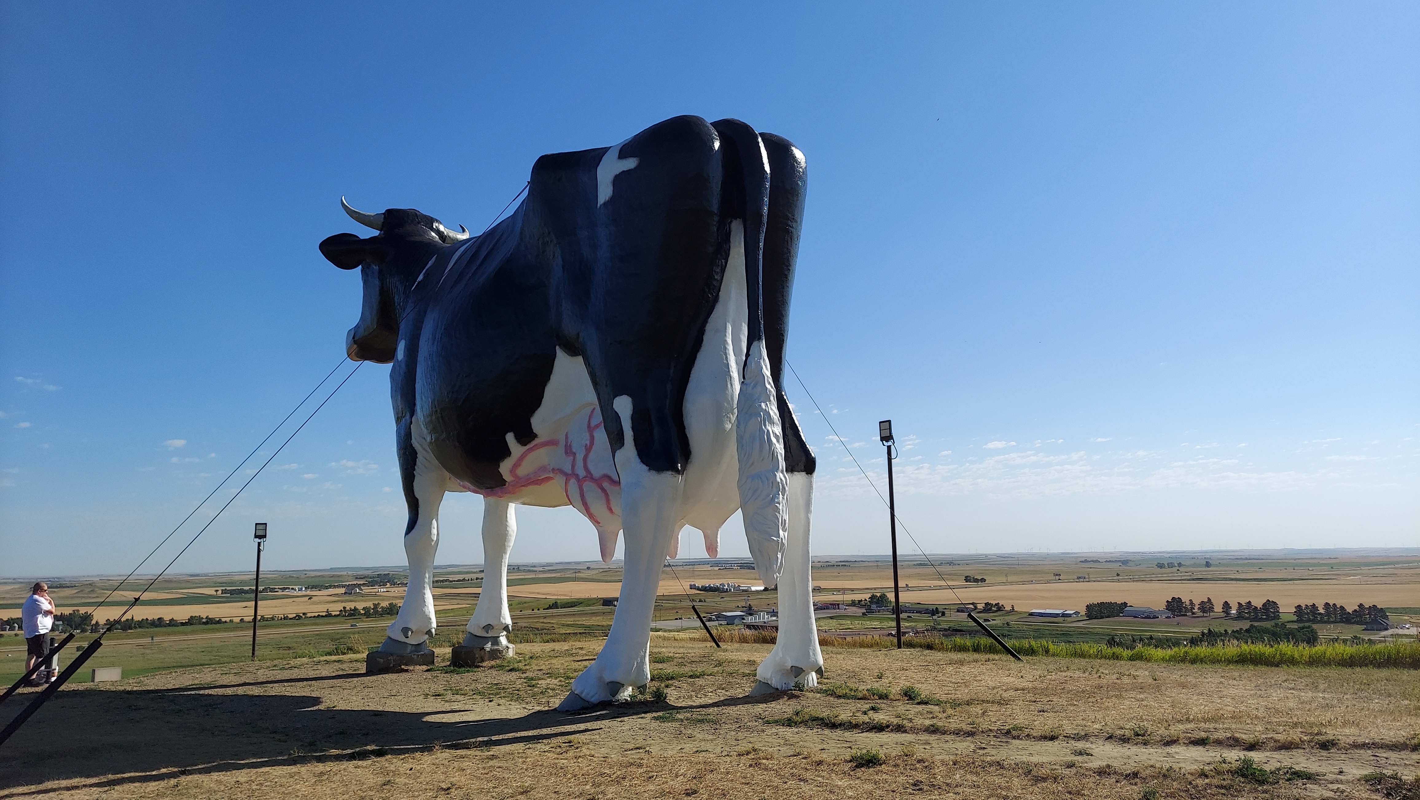
I fly across Minnesota and eastern North Dakota with few stops and spend an unremarkable night in Bismarck. The next morning I pay my respects at Salem Sue, the silent sentinel at the entrance to the West, and take in the first tentative buttes hinting at the hills and mountains to come. After numerous past visits to the South Unit of Theodore Roosevelt National Park, I swing off the freeway in Belfield and head for the North Unit. The basics here are much the same, badlands lining the floodplain of the Little Missouri River, scars and pockmarks interrupting the flatlands and beckoning the visitor in. Bison clump along the road and sometimes in the middle of it, and the campground is maybe half full on a Friday night.
I subject myself to a four-mile loop hike in triple-digit afternoon heat. The trail is mostly exposed, shooting straight up the sides of a coulee to vistas of the Little Missouri, where a few bison have taken refuge from the heat. Mercifully, the back side of the loop tucks into some juniper thickets that provide a reprieve from my blossoming sunburn, and I’ve found a campsite that has trees on all sides. Even the scattered sun hitting the hammock is miserable, so I park my camp chair atop my cooler in the shade of the trunk of the largest cottonwood I’ve ever seen and slowly rotate it to stay out of those cruel rays. My new camp gear is enough to earn me some sleep despite the heat, and I do not linger long the following morning, shooting west through the bleak impermanence of North Dakota oil country and down a long stretch of the Yellowstone River before a dive south into the Bighorn Basin.

Behind the Front Range of Colorado and the Bighorns in Wyoming, in front of the great ranges of Utah and Idaho and Montana and Yellowstone, is one of the emptiest corridors in America. It stretches from the Four Corners region in the south to the Yellowstone River in the north, 600 miles of parched country, some of the driest in the nation except along its ribbons of river: the Colorado and the Green in the south, the Bighorn in the north, these powerful waters punching through mountain ranges that separate the basins in this lonely land.
The Wind River Range is a protrusion into these inhospitable climes, thrusting south and east from the Tetons, and it is the 2024 destination for my annual hiking party. The Winds are not really near anything, and that is part of the allure for our journey this year. I spend my last night in the relative lowlands in a town selected because its name sounded fun. But it turns out to be more than that.
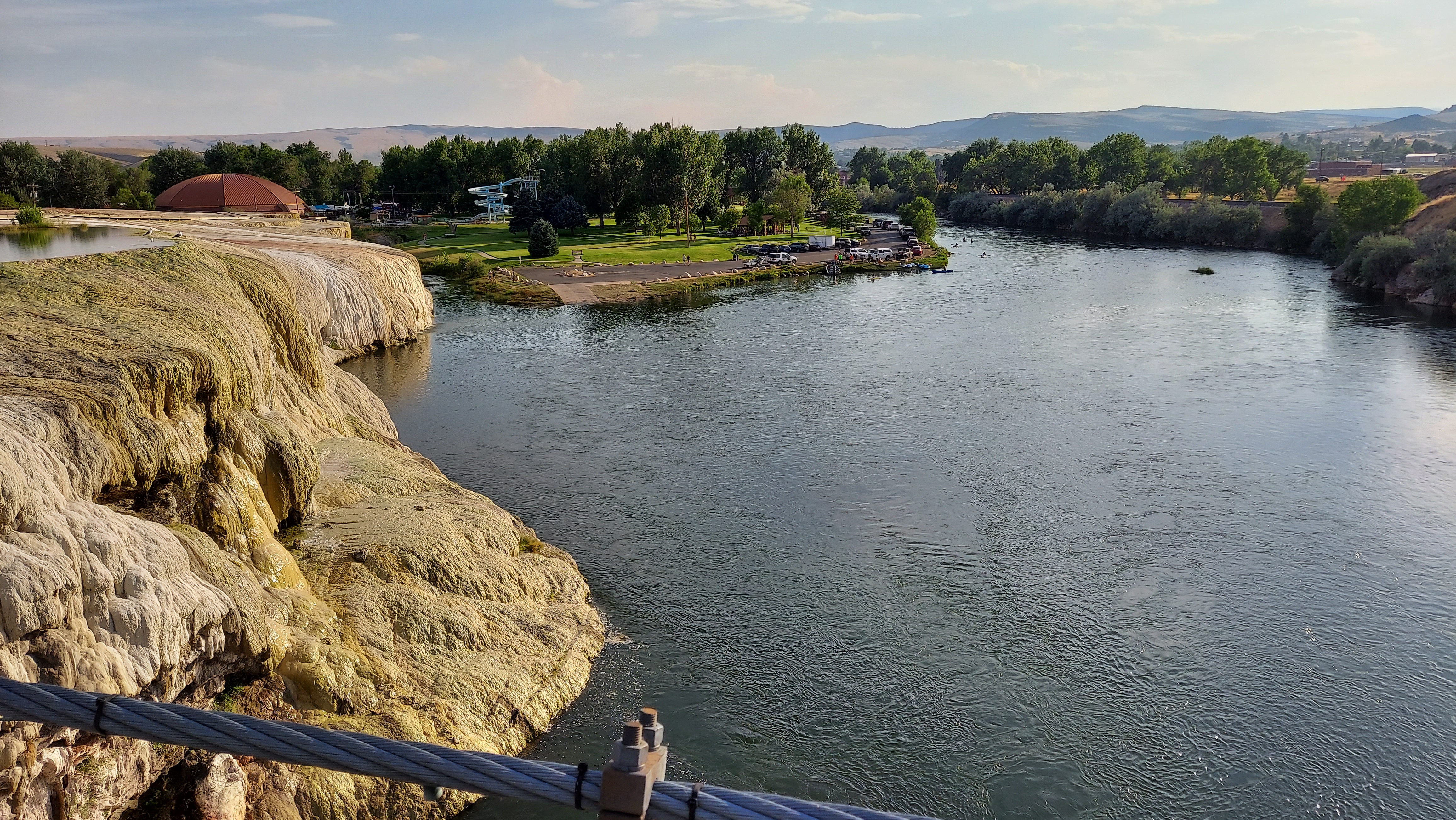
Thermopolis, Wyoming strikes me as a triumph of what the West can be. A town of just 3,000 people, it has the good fortune sit right where the Bighorn River slips out of the Wind River Canyon (the Bighorn and the Wind are, in fact, the same river), and the world’s largest mineral hot spring bubbles up beside it dumps on in. The area around the hot spring is a state park, guaranteed free for use by an age-old US government treaty with the Shoshone and the Arapaho, and I happen to visit during Discovery Days, which has a host of Native families picnicking on the sulfurous grounds around the spring. On this 100-degree day I am not too enthused about a dip in 105-degree water, so I make do with a stroll about to drink in the scene, and am too late to see the town’s top-notch dinosaur museum, too. Downtown Thermopolis has bustling shops and a surprising degree of culinary variety and a respectable brewery, where I post up at the bar and meet a couple completing the woman’s cross-country move to be with her snowboard guide partner in Jackson, and later two fishermen from Cheyenne. The snowboarder wins a few hundred dollars in a dice game jackpot, and the five of us watch Olympics and play dollar-ante dice games after that. It is a night well-spent in a town that pulls together the various strands of Western life and makes them into something whole.
From Thermopolis I head up canyon and into the Wind River Reservation. Here the Northern Arapaho and the Eastern Shoshone have land along the Wind and its merging tributaries with names like Poison and Badwater Creeks, which are in fact the two streams flanking the town of Shoshoni. This is deep rural country, though larger towns like Riverton and Lander have cropped up just off the reservation checkerboard and provide some services. From here I head up the old wagon trail route over South Pass and turn off on a steadily deteriorating dirt road into the Wind River Range, where my backpacking party will head for the Cirque of the Towers.
The rest of my fellow hikers head back to Salt Lake City after our hike, either to fly home or to carry on with their van life adventures across the West. My road back, however, is a long but purposeful one. After my descent from the Winds I head east to Casper, over rolling steppes of Wyoming sagebrush beneath moody skies, a pinprick within the great openness of the West. Early 1800s explorers called this land between the 100th Meridian and the Rockies the Great American Desert, and though it can be monotonous, the austere beauty here fills some hunger, some knowledge that these wastes hold some secrets and that crossing them can unlock some greatness.

I stop at Independence Rock and the National Historic Trails Interpretive Center, markers on old roads west, monuments to the toll these lands once exacted on those chasers of western dreams. Now, I shoot across them in a matter of hours, endure dreary Casper and then spend the next night in Hot Springs, South Dakota, where I see a collection of mammoth remains interred here on the southern end of the Black Hills. Most Western towns tend toward the simple, the impermanent, just the basics set up here to provide the necessities. But they also feel the past deeply, their stories told by the events that once happened here, and they guard these stories better than in the east or the far west where it might be paved over, subsumed by the march of progress. Instead progress drifts through here from time to time, leaves its mark but tends to move on, and the West eases back into a more timeless state.
The next morning I head toward the Pine Ridge Reservation, an experience that deserves its own post. But after that the rest of the drive across South Dakota passes easily enough. Grazing cattle beget sunflower fields beget corn and wheat. There is some momentary Badland delight before Kadoka, a swing past a second Dakota capitol building, and a skirting of some pleasant lakes to break up the endless fields and tired farm towns with a few nice new houses on the outskirts.
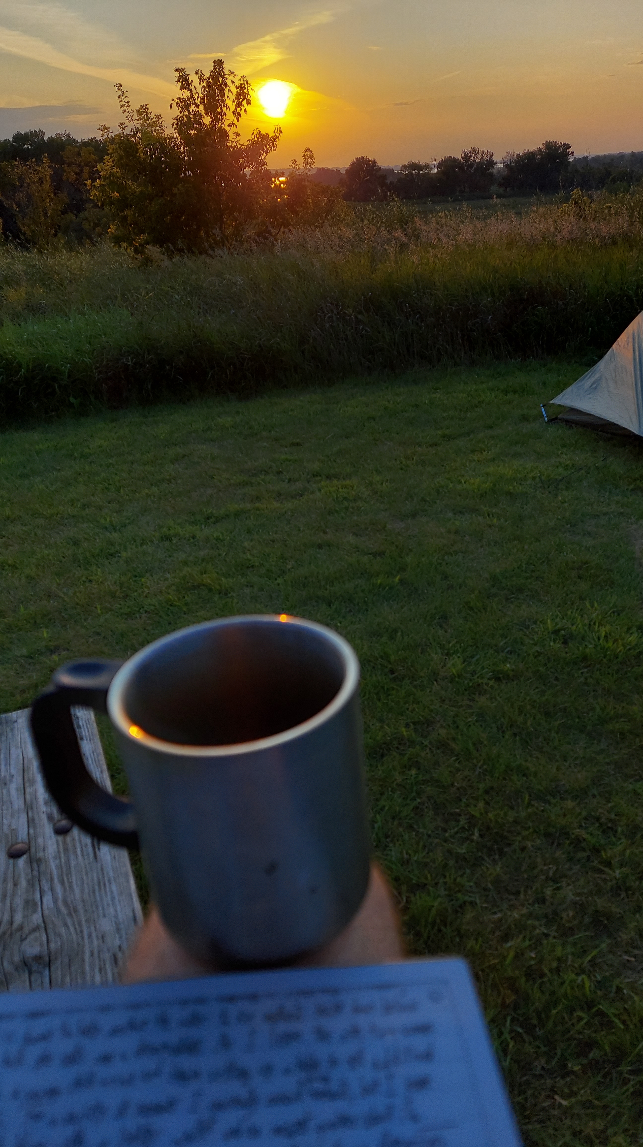
I spend my final night of travel at Lac qui Parle State Park, just across the Minnesota border, in a walk-in campsite amid prairie grasses with a view down to the lake that speaks. It is a perfect evening, and I write easily, the crickets amid the oak savanna pulling me back to some of my deepest-rooted snippets of memory, of warm summer nights outside Madison. (Wisconsin, that is: Madison, Minnesota is the nearest town to Lac qui Parle.) The campground is quiet, mostly empty, but a couple of fires crackle and a warm glow emanates from the camper cabins. A few Pleiades streak overhead. Worries drain away, nagging doubts fall into nothing. I have faith and I have a mission, and a blank space in which to write a name.
